Seo áiteanna
speisialta i gContae Mhaigh Eo ina bhfuil gnáthóga áirithe.
These are special areas of conservation in Co. Mayo.
Rinne Rang 4 staidéar ar roinnt de na suíomhanna chun foghlaim faoi ghnáthóga difriúla.
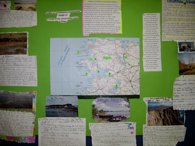
Fuair siad pictiúirí agus eolas faoi na háiteanna. Cuireadh an postaer sa halla.
|
|
Ocht nGnáthóg i gContae Mhaigh Eo
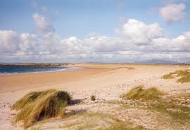
1: Trá ag Doogort
|
This
is a small sandy beach located on Achill Island which is within a special
conservation area. The Doogort beach got the blue flag award. It gets
a national spring clean every year. The Doogort beach is along the coastline
of the map above. It is 3 kilometers east of the Doogort village. It is
on the western seaboard, with low, flat, windswept sand plains known as
machair. Machair is a vegetation-covered coastal plain. There are a lot
of endangered species at Doogort Beach. There are a lot of holiday homes
in Doogort. The beach is 2 miles from the village. There are waders, tern
and gulls on the beach.
|
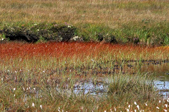
2: Portach ag Ballycroy
|
Ballycroy
National Park was established in November 1998. It is Ireland's sixth
national park and is located on the western seaboard in the northwest
Mayo.
It comprises of 11,000 hectares of Atlantic blanket bog and mountainous terrain covering a vast unhabitated and unspoiled wilderness dominated by the Nephin Beg mountain range. This is one of the last intact active blanket bog systems in Ireland. There is a diversity of habitats within the National Park . On the highest peak, slieve carr alpine health is found. Other habitats include upland grassland, wet and dry heath. It is a unique habitat with a diverse flora and fauna. Blanket bog, cliffs and river habitats are found in the park. The blanket bog is one of the largest expanses of peatland left in Europe. |
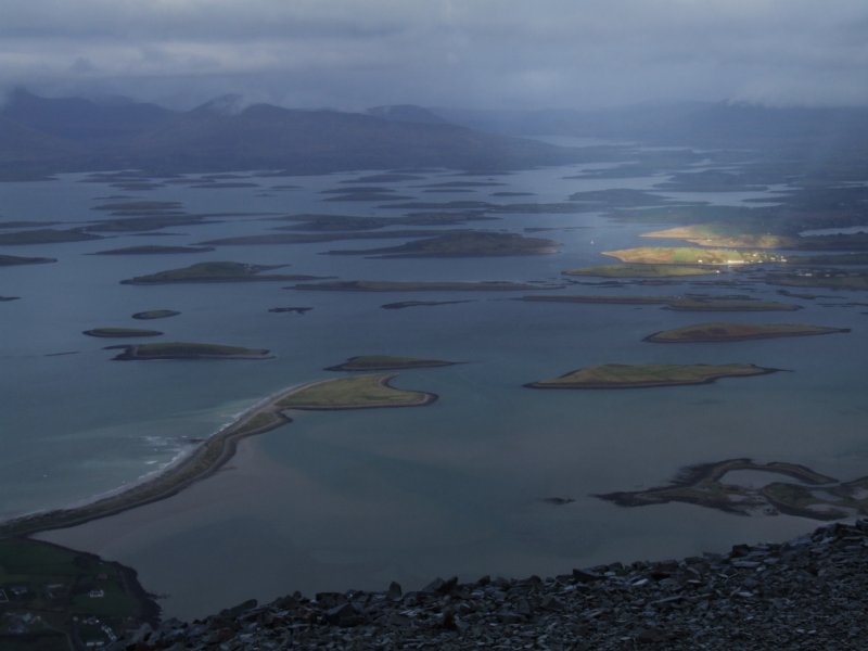
3: Cuan Mó (Clew Bay)
|
Clew Bay is a
natural ocean bay in Mayo. |
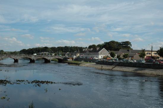
4: Abhainn na Muaidhe (the Moy River)
|
The
Moy was a 1,697 ton, iron ship with the length of 257 feet, named after
the river Moy. The Moy was once among the best salmon fisheries in Europe;
however, in recent times, drift net fishing off the coast caused a huge
decline in salmon numbers. The River Moy rises at the foot of Knocknashee
in the Ox Mountains in County Sligo. The river Moy is connected to many
lakes and streams. It is said that fresh salmon ran the Moy every month
of the year. All fishing methods are allowed on most fisheries except
natural shrimp. The Moy is 62 miles long and enters the sea at Ballina.
The sea trout fishing is confined to the estuary. It can be very good
from April to September
|
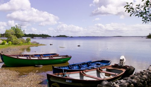
5: Loch Measca (Loch Mask)
|
Lough
Mask is a limestone lake. It is the upper of two lakes which empty into
Lough Corrib. The trout in the lake are up to 15 lb in weight. Lough Mask
is renowned for its high quality water. Fly fishing extends for most of
the season. Mayfly are best from mid-May to mid-June. Daddy long legs
and grasshoppers are also found beside the lake. Dry fishing is successful
from May to September. The lough was the scene of the Lough Mask murders
in 1882, when two workers for Lord Ardilaun were killed.
|
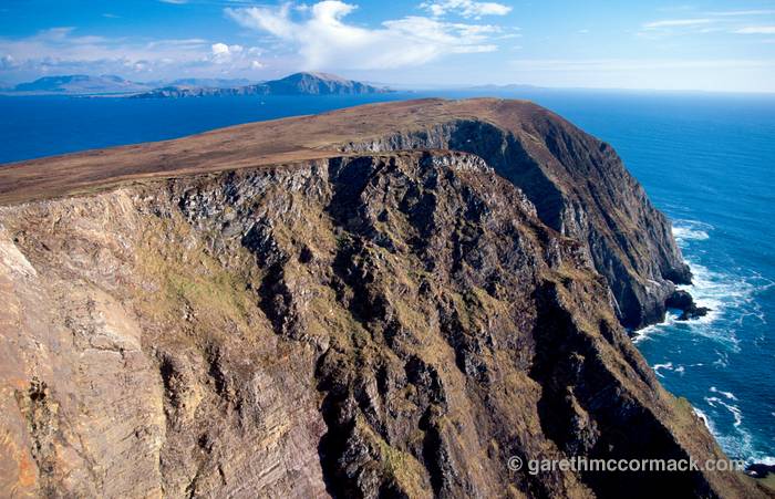
6: Aillte ag Oileán Cliara (sea cliffs at Clare Island)
|
Clare
Island cliffs lie off the west coast of Ireland. The sea cliffs off the
Northern coastline consist of vertical precipices alternating with steps.
On the upper cliffs, there is a conentration of alpine weather plants
which is species rich and includes a number of rarities. On the west and
north sides of Clare Island the spectacular cliffs offer the bird watcher
a wonderful opportunity for viewing nesting sea birds. The cliffs of Clare
Island lie at the of entrance of Clew Bay. The cliffs of Clare Island
are very high. It is very steep when you look down. It is hard to climb.
It is in the west coast of Mayo
|

7: Oileáin Inis Cé (Inishkea Islands)
|
There
are two Inishkea Islands, Inishkea North and South.
The Islands are rich in amazing scenic beauty, rare wild life and numerous Archaeological sites.The Inishkea Islands are of major importence to both resident and migrating birds with over 85 types having been recorded. The Mute Swan, the Peregrine and the endangered Corncrake are just some of the bird species which benefit from the peace and protection of the islands. Fishing was the main livelihood of the people of the islands of Inishkea. Large numbers of Barnacle Geese spend the winter in the Inishkea islands. The Eurasian otter is an aquatic rather than a truly marine mammal. The grey seal assembles for breeding on the Inishkea Island Group and at the Blasket Islands. They were studied in 1995 and 1996. The grey seal is also a coastal species, though it may forage further out at sea then the common seal. |
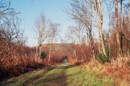
8: Coill ag Brackloon
|
Brackloon
woods trail is 0.4km. in distance. Brackloon Woods are near Westport.
The walk in Brackloon woods would take 1hr 30 minutes. The degree of difficulty
is easy. The terrain is a woodland track. Brackloon Wood is a surviving
remnant of the original wooded landscape. Brackloon woods is now classified
as a semi-natural Atlantic oak woodland. Apart from the woodland trees,
other flora to be seen include wood sorrel, hard fern and bilberry.
Fauna common to the area are badgers, foxes and pine martin. |